
When you picture South Korea, your mind probably goes to neon signs, busy cities, and K-pop performances rather than hiking. It doesn’t have a reputation as a destination for those who love the outdoors.
And yet, hiking is South Korea’s national pastime. About 70% of the country’s terrain is made up of low, forested mountains. Every weekend, hoards of retirees head to its 22 national parks to scale the trails. Dressed in brightly colored sweat-wicking gear, they are humblingly fast. When I grow up, I want to be a Korean septuagenarian.
I spent most of my time in Korea on a cross-country bike trip, but also managed to fit in trips to several national parks. I loved the atmosphere and culture on Korean hiking trails.
People are very friendly and helpful.
There are well-marked trails and affordable mountain huts to sleep in.
Korean trail builders despise switch-backs, and many routes run straight up the steepest section of a hill, creating some technical terrain that is super fun to climb.
Trailwise, there is something for everyone – short trails, multi day hikes, coastal and mountainous routes. Keep reading to find the right fit for you, in this complete guide to the best hiking in South Korea.
Why You Should Go Hiking in Korea
Hiking in Korea is as much a cultural experience as it is a physical one. Trails are often dotted with Buddhist temples, pine forests, and rest stops where hikers share fruit or chat over makgeolli (Korean rice wine).
Most cities are within easy reach of mountain trails, and many locals hike weekly, even in their 70s or 80s. The trails are usually well-marked, clean, and have rest areas, toilets, and water stations. This makes it very easy to go hiking in Korea, and wherever you are, you can probably find a trail to follow.
Best Hiking Trails in South Korea
Bukhansan National Park – Best Hiking in Seoul, South Korea
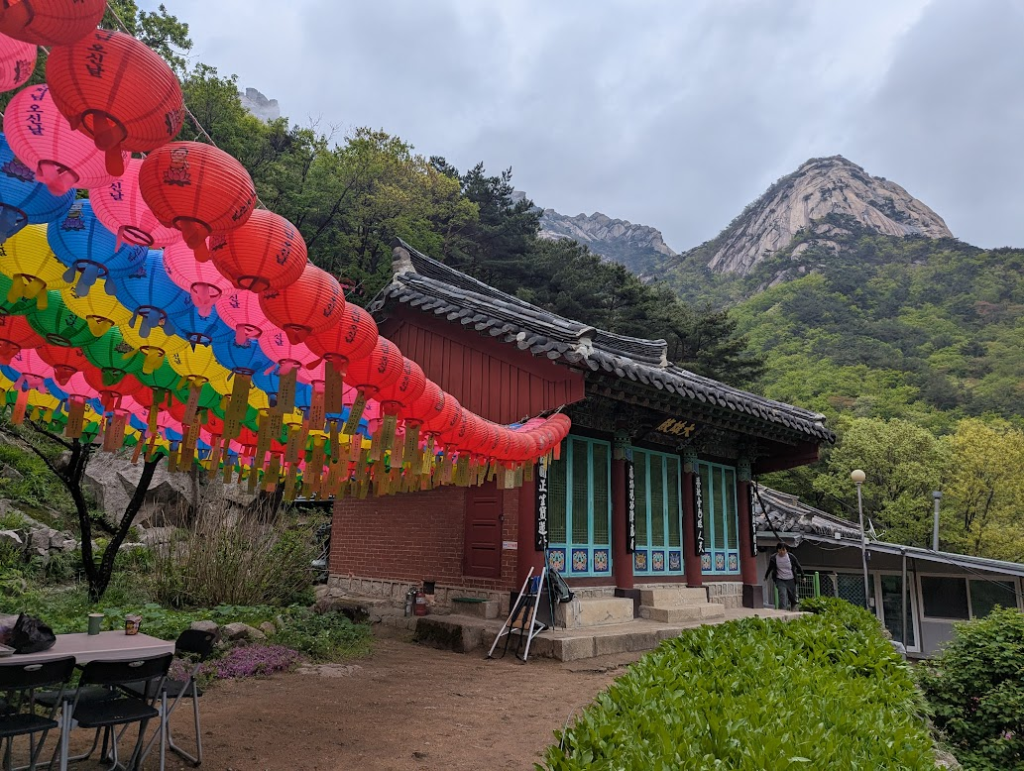
You don’t have to leave the capital to go on a hike. Bukhansan National Park lies within the Seoul city limits and has over 130 km of trails. You can reach it by subway, yet as soon as you step inside, the city feels like it is a world away.
The most popular trail is Bukhansanseong Course, also known as Bukhansan main route, which takes you past Buddhist temples and ancient fortress walls, up to Baegundae Peak (836.5m).
The last section is quite technical, involving scrambling up rocks and pulling yourself up with ropes. I love this kind of hike, and thoroughly enjoyed it, despite the fact that it was a rainy, cloudy day. By the time I reached the top, it was so misty that I missed out on the views of Seoul, but I am told that they are superb.
How to get there
Take the bus to Hyoja security center, which is a short walk from the park entrance. You can cross the park from West to East and emerge in Ui-Dong, which has a subway station.
How much does Bukhansan National Park cost?
Bukhansan National Park is free to enter.
What facilities are in Bukhansan National Park?
There are convenience stores and restaurants near to all entrances to Bukhansan National Park. On the lower section of the trail, you’ll find some toilet blocks and water points.
Sobaeksan National Park – Best Ridge Walk
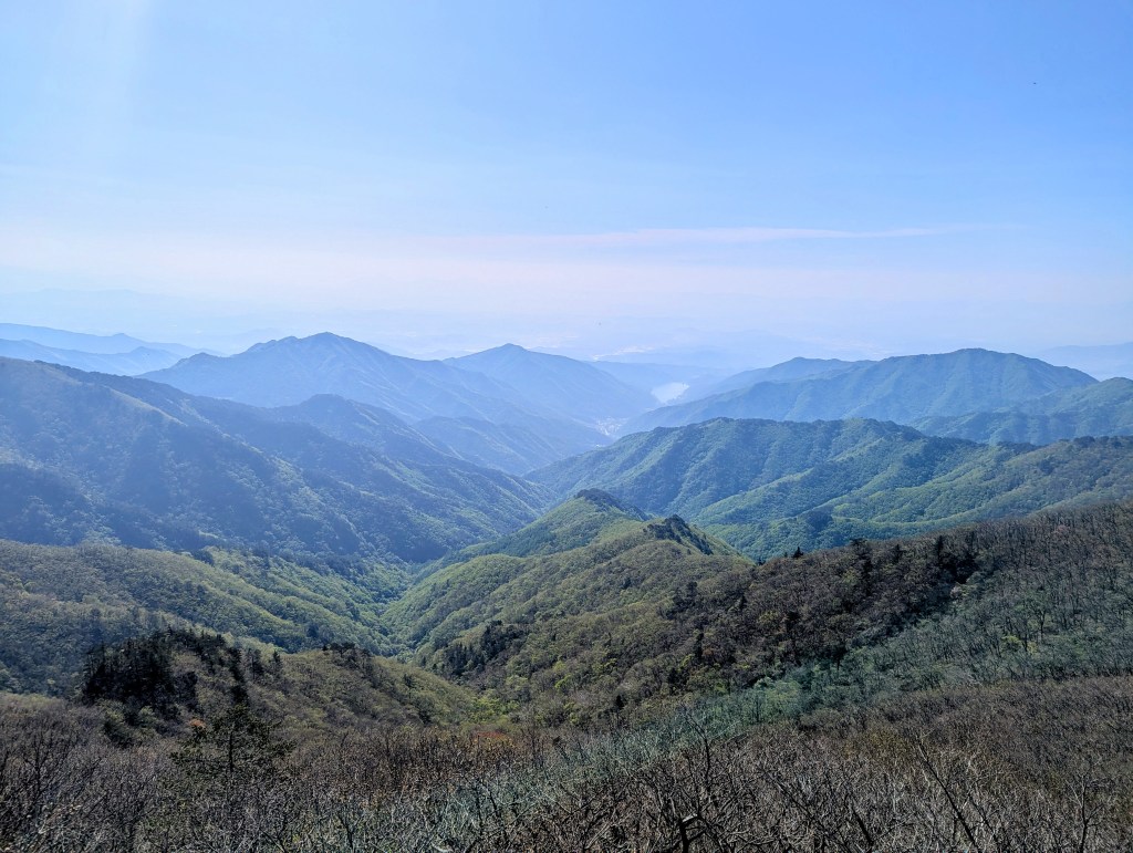
If you are a fan of silhouetted hills in fifty shades of gray, getting paler and paler as they fade into the horizon, come to Sobaeksan. You’ll have days of over 2000 metres elevation gain, but it will be all be worth it for the ridge views.
This area in the center-east of Korea is properly mountainous, with its highest peak reaching 1439 metres.
The best, and most popular hike is the Sobaeksan ridge trail. As its name suggests, it follows a ridge line, and it is absolutely gorgeous. The ridge is free of trees, and has wide fields on either side, which fill with wild flowers in the spring.
Sobaeksan has one mountain hut to sleep in (제2연화봉대피소 or Je2Yeonhwabong Shelter). Unfortunately, it is right at the start of the ridge trail, so it doesn’t help to break up the trail. Still, it is a great place to sleep, located on the Je2Yeonhwabong peak, and overlooking a space station.
How to get there
The closest towns to Sobaeksan are Punggi or Danyang, both of which are connected to Seoul and other cities by bus. From Punggi, you can take a local bus or taxi to Choamsa Temple or the Jukgye parking lot, both common trailheads. From Danyang, take a bus to Cheongdong parking lot or Huibangsa Temple to start your hike.
How much does Sobaeksan National Park cost?
Sobaeksan National Park is free to enter.
What facilities are in Sobaeksan National Park?
Most entrances have visitor centers and small shops, Once you’re on the trail, facilities are limited. Since most trails run along the ridgeline, there are no water sources, so make sure to bring enough water.
Woraksan National Park – Most Wild Trails
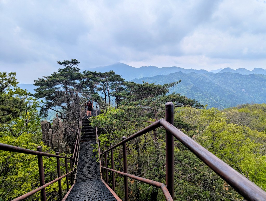
Almost slap bang in the middle of South Korea, Woraksan National Park offers a landscape of rolling mountains that rivals the better-known Sobaeksan — but with a wilder edge. While both parks feature sweeping forested ridgelines and scenic peaks, Woraksan’s trails feel far less trodden and a lot more adventurous.
Many of the hikes here involve scrambling over narrow, rocky ridges, sometimes with the help of ropes or metal railings bolted into the rock.
Woraksan National Park and Sobaeksan are next to each other, separated only by a road. We started from Chungju side, and walked through Woraksan then Sobaeksan, before getting a bus to Danyang. It took three days and really took in the highlights of both parks, I thoroughly recommend it!
How to get there
The easiest access point is Jecheon, a city well connected by train and intercity bus. From Jecheon Bus Terminal, take a local bus or short taxi ride to Woraksan National Park (월악산국립공원) — the Deokju Valley entrance is one of the most popular. I entered the park from the Mungyeong side, which is a short bus ride from Chungju. There is a very cute village there, surrounded by forests and filled with restaurants and coffee shops.
How much does Woraksan National Park cost?
Woraksan is free to enter.
What facilities are in Woraksan National Park?
Facilities are more limited than at major parks like Bukhansan. At the Deokju Valley entrance and other main access points, you’ll find visitor centers, toilets, and a few restaurants or snack stalls. On the trail, expect minimal infrastructure — bring plenty of water, especially if you’re planning on following the ridgeline.
Hallasan National Park (한라산국립공원) – Jeju Island – Korea’s Highest Point

The highest mountain in South Korea, at 1,947 metres, Hallasan is located on Jeju Island. The extinct volcano looms over the landscape, and the peak is traditionally known as Grandma Seolmundae, seen as a deity in its own right in the local shamanic religion.
There are two routes up to the top: the Seongpanak trail and the Gwaneumsa trail. The Gwaneumsa route, from the north, is steeper. It takes about 3 – 4 hours to climb the 1,500 metres of elevation over roughly 8.7 kilometres. The Seongpanak trail, from the east, is longer (9.6 km) but more gradual, and less technical. Both are served by public transport, so you can start at one end and descend via the other.
I got the bus from Seogwipo to the trailhead at Seongpanak. This worked really well, giving us plenty of time to climb the peak. It was a spectacular climb — misty forests, volcanic rock, dramatic slopes — and then we arrived at the very windy summit, where we could barely stand long enough to see the lake in the crater.
You need to register online no more than a day in advance to climb Hallasan and pick a time slot to begin. You’ll receive a QR code, which you show at the entrance to get a wristband and be allowed to enter. If you miss your departure slot, you may be refused entry. The mountain closes early, with the last possible ascent starting at noon, so keep an eye on the time — this is strictly enforced.
How to get there:
Hallasan is easily accessible from both Jeju City and Seogwipo, the island’s two main hubs. Local buses run frequently to both trailheads — Seongpanak and Gwaneumsa. From Jeju City, take bus 181 or 281 to either trailhead (about 30–40 minutes). From Seogwipo, buses 181 or 182 go to Seongpanak in just under an hour.
How much does Hallasan National Park cost?
Entrance to Hallasan is free, but you must reserve a hiking slot online in advance via the Visit Halla website or app.
What facilities are in Hallasan National Park?
At both Seongpanak and Gwaneumsa trailheads, you’ll find toilets, small visitor centers, and parking lots. The Gwaneumsa trailhead also has a small shop.
The Baekdu-daegan Trail: Korea’s Thru-Hike
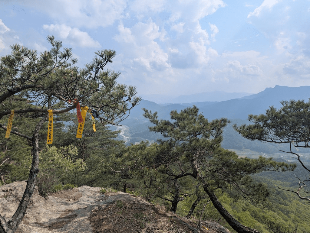
If you are looking for a longer adventure, Korea also has a thru-hike – the Baekdu-daegan Trail. It links together ridgelines through a series of national parks, crossing the country from the North East to the South West.
This thru-hike stretches roughly 700 km from Mount Baekdu near the North Korean border (inaccessible from the South) to Mount Jirisan in the south. In South Korea, the hike typically starts from Deogyusan or Jirisan, depending on your direction.
The first person to have completed it all was Roger Shepherd – he was even allowed into North Korea to hike the continuation of the ridge, on the other side of the border.
Most Koreans approach the hike in segments – without the north korean side ofc – doing a few dozen kilometres on the weekend. A few foreigners do the full thru-hike each year – but it is definitely more of a solo adventure than a social thru-hike.
We followed a section of the route in Sobaeksan and Woraksan for four days, and encountered only a handful of hikers.
It is worth noting that some portions of the hike are periodically closed – a way of keeping the nature safe by closing access t tit for some periods, and also away of avoiding wildfires.
It was very hard to find information ahead of time about what would be closed, which was rather inconvenient.
- Time required: 40–60 days
- Distance: 700+km
- Trail type: Unofficial, often marked by local hikers and communities
Frequently Asked Questions (FAQs) About Hiking in Korea
Where can I stay overnight?
Wild camping is forbidden in national parks. Some trails offer basic shelters (called “shelter houses”) that you can book in advance via the Korea National Park Service website: english.knps.or.kr.
When is the best time to hike?
Spring (April–June) and autumn (September–November) are ideal for hiking, with mild weather and beautiful foliage. Avoid summer for heat and monsoons, and check conditions in winter before tackling icy trails.
What snacks should I bring?
Popular Korean hiking snacks include gimbap, dried squid, trail mix, and chocolate. Convenience stores near trailheads sell ready-to-go options. Bring enough water—sources on trails are limited.
Any trail etiquette I should know?
Nothing surprising. Say hello with a friendly “안녕하세요” (annyeonghaseyo), keep noise to a minimum, don’t litter, and step aside for faster hikers. Walking sticks should have rubber tips to protect the trail.
Other articles you might enjoy:
Top Ten Things to do in Seoul, Korea

Leave a reply to 15+ Things To Do On Jeju Island, Korea – Shortcuts and Side Quests Cancel reply